Shopping cart
Your cart empty!

How the Urban Planning Department turns multi-billion-point LiDAR surveys into clear public consultations, open to everyone from a browser.
Every major Paris project starts with a massive 3D survey. The real challenge is making residents understand it. With View4Sight, the city turned its point clouds into a tool for dialogue, not an expert-only file.
Major development projects generate colossal 3D surveys: LiDAR point clouds, BIM models, orthophotos. But to present them to the public, teams were stuck with 2D plans and static renders. In meetings, few residents could truly picture the project: consultations dragged on and misunderstandings piled up.
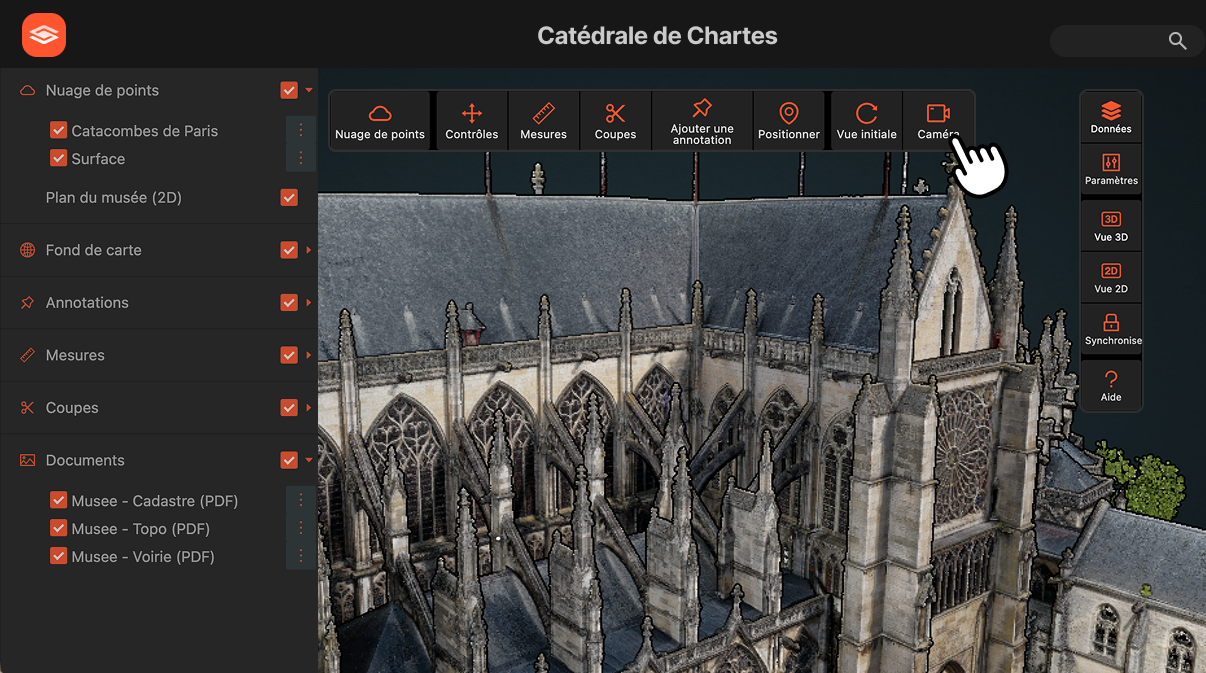
The city's teams upload their LiDAR surveys and models into View4Sight, with no downsampling. A single link is enough: any resident explores the neighborhood in 3D, from their phone, with nothing to install. Staff annotate, measure and compare development scenarios side by side. And everything stays hosted in France.
Billions of points loaded as-is, smooth even on a modest laptop.
Residents explore the project in 3D in their browser, no account, no install.
French hosting, GDPR compliance, full access control by the city.
By making projects tangible, the city saw participation climb, discussions sharpen and approval timelines tighten. Residents no longer merely endure projects: they explore them, comment on them, and help shape them.
For the first time, residents step inside the project before it even breaks ground. 3D changed the very nature of consultation: we no longer present a project, we share it.

Join 10k+ people to get notified about new posts, news and updates.
Do not worry we don't spam!